Sunday, May 30, 2010

Tornado!

It took several weeks of traveling the plains, but I finally saw a tornado last week, 2 in fact! They were short-lived (the first had dissipated by the time I got my camera out!), and far away, but they were real-deal tornadoes.


This was especially exciting since we've often been pretty far from the "business end" of the storm for our balloon operations this year. We've been going at a pretty torrid pace for the last few weeks, intercepting storms in New Mexico, Texas, Oklahoma, Nebraska, Kansas and Colorado since my last post.

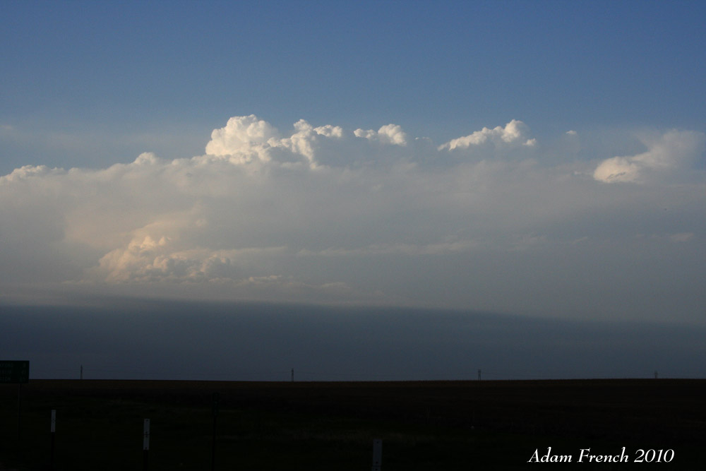
This included a long-lived supercell in TX that we were able to collect a lot of good data on:


We also saw some great mamatus clouds outside of Roswell, NM, along with some dust being kicked up by strong surface winds.


In fact, the whole ride to the hotel from Roswell was quite picturesque:


We've also had some down time, including a visit to the Badlands National park last Friday while we were traveling from South Dakota down to Nebraska, where we operated yesterday. The whole sounding team was there, along with the Field Coordinators (their truck is the ambulance-looking thing in the back)


And the obligatory truck shot, this time of 2/3 of the "NCAR Family", NCAR1 and NCAR2 (NCAR3 was behind me while I was taking the picture).


Tomorrow is my last day with V2 before heading home, hopefully we'll get one last good operations day before I leave. Even if we don't, though, I'm definitely looking forward to seeing Miranda and Dixie, and to sleeping in my own bed again!

Monday, May 24, 2010

Little Breezy Today

We had a fun-filled day of operations today, more so because the large-scale surface winds were sustained at 40+ mph at times than because of the storms, which were actually on the marginal side. We figured it was going to be difficult to launch just because it is harder to launch a giant weather balloon in windy conditions, but we had no idea just HOW hard it was going to be until our first attempt.

We fanned our teams out in a line about 30 miles apart along I-80 in Nebraska for our initial operations today, and went for our first launch around 2 pm. Bryan (my NCAR buddy today) and I found a nice open field to launch from. We got the sonde ready and then went to fill the balloon, hoping to use the truck as a bit of a wind block, and as shelter from all the dust/debris being kicked up. As you can tell from some of the pictures in my other posts, these balloons are rather large, about a 3m diameter when fully inflated. Usually when it's windy we have one person operate the helium tank and hold the neck of the balloon, while the other kind of bear-hugs it to keep it from blowing around. Given my rather large wingspan, I'm usually a pretty good balloon bear-hugger. However today as we attempted this it was apparent that no measure of bear hugging was going to work. Our first balloon got away from me and started whipping around as Bryan tried to fill and hold on to it. It ended up twisting around causing a pocket of helium to form right above the neck, a relative weak spot. Before we could react, POP! the pocket burst, and we were left holding the neck of the balloon, while the rest of it floated/blew away quite rapidly. Mind you, there weren't even any storm nearby at this point, it was still sunny out, and these were just the background winds.

Undeterred, we grabbed another balloon and started filling. This time we just let the balloon stretch into the wind (and stretch it did!). We got it filled, and then came the challenge of attaching the sonde. It went something like this: Bryan held the sonde while I held the balloon with both hands, it whipping around wildly and effectively pulling my 200lbs down the road (seriously), while trying to thread and cinch a zip tie around the sonde clip to attach it. Trying to thread a zip tie through the little zip tie closing mechanism under these conditions was darn near impossible. After what seemed like an eternity, I got the sonde attached and cinched down. Balloon was still inflated, sonde now attached, I was barely keeping my feet planted, Bryan checked the computer and we were good. I let the balloon go and it shot away so violently that the string attached to the sonde snapped and the sonde fell into a field about 20 ft away as the balloon raced sky-ward.

Before a third try we checked in with the the sounding coordinator (Dr. Parker) to find out that everyone else was having similar problems. We scrubbed our launch, and we all regrouped, working in teams of two trucks, giving us 4 people total to manage the balloon. We joined up with Casey and Heather in the other NCAR truck who had figured out that there was enough room in the back of their truck to fill the balloon and attach the sonde inside, relatively sheltered. However, this still took some refinement, as during our first attempt using this method the balloon once again flew away so quickly that the string snapped off and we were left this time holding the sonde as our balloon cruised away. We eventually worked out a system of counting to three and simultaneously chucking the balloon and sonde out of the back of the truck, which managed to work. The only thing we had to worry about now was making sure we had plenty of open space over which the balloon/sonde could rise, as the strong winds caused the whole system to move laterally a considerably amount before gaining enough altitude to clear things like trees and telephone poles. One of our other teams reported getting a successful launch only to see their sonde bouncing along the ground behind their balloon before it was able to gain enough altitude. The same team reported nearly hitting a light pole during one of their launches, on the opposite side of the interstate from where they launched! All in all, it was a wild day for balloon operations.

Our story does have a happy ending though. We recovered our first sonde from the field intact and it went on to fly successfully by the end of the day. An important achievement when one considers that these sondes runs about $180 a piece!

Sunday, May 16, 2010

Busy Week!

We had quite a busy past week for V2, chasing Monday, Tuesday, Wednesday, being on standby but not chasing Thursday, then chasing Friday and Saturday! So finally, just like the big weather-maker upstairs, on the seventh day we rested...and did laundry. Anyway, here's a bit of a recap of the last week in pictures. We did manage to intercept several supercells, a few tornadoes, and most importantly we collected some really good data!

On Tuesday we chased in western OK:


And met Chase the V2 weather Dawg


And of course we launched plenty of balloons (here's Bill showing how it's done):


Unfortunately the best storm didn't develop until it was almost dark.


We chased western OK again on Wednesday, and collected some good data on a supercell that produced a tornado near Clinton.


After our travel day on Thursday, we were back in action Friday in southwest TX. Another tornadic supercell...but this one rapidly evolved into more of a line while we continued to collect data.


Finally, on Saturday we made our way into southeast New Mexico....and caught yet another supercell. No tornado, but lots of big hail. The storm looked pretty as it began to dissipate in the fading light.


And we were rewarded with a pretty sunset:


And now, with clean clothes and a dinner at Olive Garden, we're ready to roll for what looks to be another busy week!

Monday, May 10, 2010

First Tornadoes of V2 2010

V2 intercepted multiple tornadic supercells today across central Oklahoma. I've had visions of creating a great blog post full of pretty tornado pictures when this day arrived, but alas, my team was far from the tornadic action. Based on the forecast storm motions of 40-50 mph, we decided to deploy our sounding teams in essentially a big box, with my truck being positioned at the northwest corner of the box. As it turns out, the tornadoes occurred at the southern end of our box (keeping our two NSSL trucks busy dodging storms and re-positioning), and aside from having to move at one point to avoid one intense cell, that may have been producing hail, my truck was pretty far removed from the action, and actually ended our day in sunshine!

So, no exciting pictures from our first tornado day, although we did launch a lot of balloons, and hopefully got some good data. It was a bit of a surreal experience though, as from where we sat the storm just looked like some dark clouds, and we were far enough away that it didn't appear all that menacing, yet all the while we were hearing increasingly dire reports on the radio and TV of major damage and loss of life in the greater OKC area. In particular there were some hard hit areas in Norman, very near where we had been prepping for ops last week. As in "the tornado missed the National Weather Center by 200 yards". We definitely had several "holy crap we were just there" moments seeing some of the pictures on the news as well while eating dinner at a local restaurant where some of the staff had to leave early because their homes had been destroyed by one of the tornadoes. As it is I'm sitting in a dark hotel because the power is still out from when the storms came through this area (this post is being brought to you by Verizon MiFi, by the way), but that's a far cry from some of the more serious damage. My heart goes out the people who lost loved ones (at least 5 fatalities reported so far), and those who lost their homes. I can't say I'm looking forward to the trip down I-40 in the morning which will likely take us past some of the damaged areas.

Looks like we may be operating again tomorrow....stay tuned.

Thursday, May 6, 2010

First V2 operations day of 2010

After much anticipation, and several rounds of frisbee, we had our first operational deployment of V2 today. No tornadoes, but we did intercept a storm that intermittently showed signs of rotation, and all in all had a good first operations day for the sounding teams.

We started our day in Hays, KS, where my team (NCAR1) and one of the other teams (NSSL1) launched a pre-storm sounding to see how the environment was evolving early in the afternoon.

Here are Bill, Matt (Dr. Parker) and Johannes watching the balloon sail into the sky just after launch.


A few hours later, Bill (from NCAR) and I headed west on I-70 to a lovely rest stop by mile marker 97 to launch a second pre-storm sounding, in the hopes of finding a more favorable environment for storms. On a side note, I'm planning a future adventure to find out why there's a Tomcat parked alongside I-70 in Wakeeney, KS.

This picture begs the question, "Why is this fellow squinting into the sun whilst his sunglasses sit uselessly on his hat?"


And while it might not look graceful, I still managed to get the balloon airborne.


Eventually the atmosphere cooperated and produced a storm. The first of several, in fact to develop along frontal boundary that was located across northern KS. Unfortunately, the later storms developed after dark, so aside from providing us with some cool lightning on the way to the hotel, they were of little use to the V2 project.

Here's our target storm, as Bill and I approach from the southwest.


Tomorrow looks to be a travel day, as we're likely heading south to get into position for further operations later in the weekend or early next week!

Monday, May 3, 2010

VORTEX 2 (frisbee) action!

The trucks are loaded up. All our equipment and software has been tested and is (mostly) functional. And we have blue skies and nice warm, dry weather. Looks like it will be a few days until we get some real storms to go after. The last big storm system to move across the country (the one that brought the tornadoes and flooding to parts of the southeast) has effectively cut off our flow of moisture from the Gulf of Mexico, leaving us with pleasant but disapointingly non-stormy skies.


So we spent our morning playing frisbee at the National Weather Center, before rolling out to western OK to meet up with the rest of the V2 armada. Hopefully we'll get something to chase in the coming days, although prospects still look rather bleak at the present. Nonetheless, here are some shots of the sounding team "in action."


Casey launches a might throw...


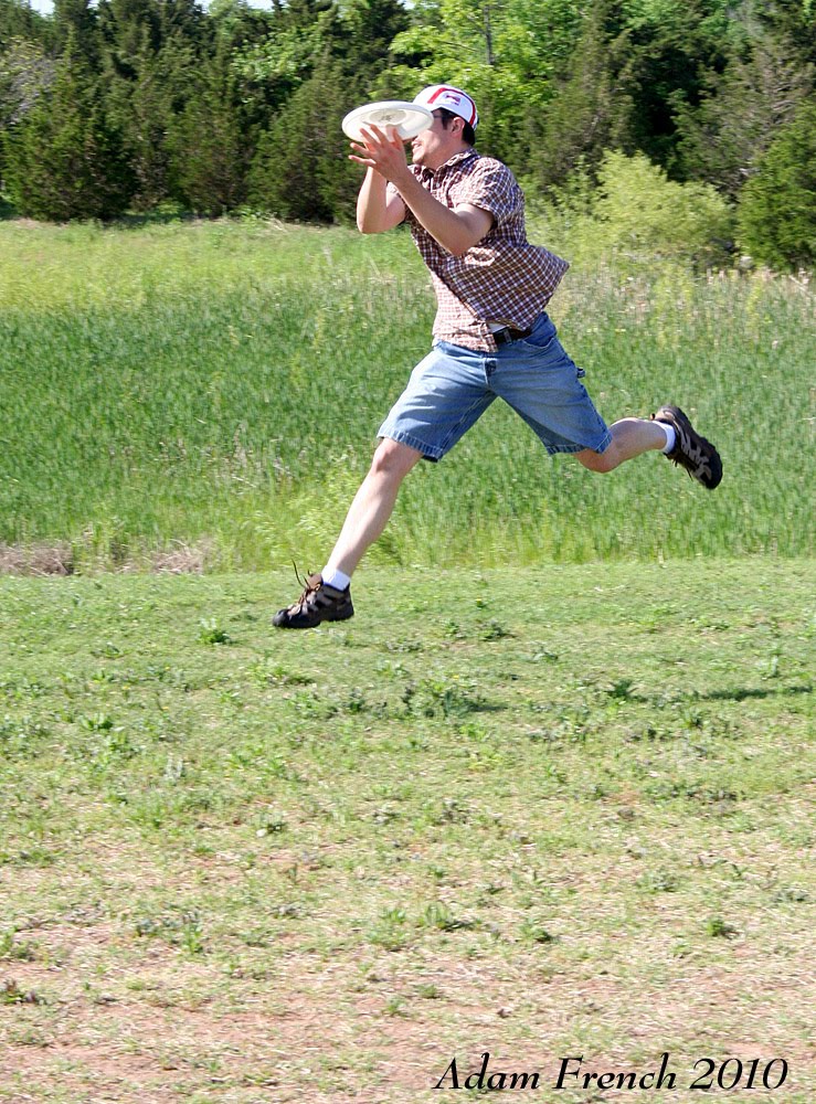
...and Matt makes a flying catch!


All the while, Casey B. makes it look easy.

Hopefully some storms show up before I dedicate a post to tossing around the Vortex (2) football!

Saturday, May 1, 2010

The Adam Has Landed

We're on the ground in Norman, waiting to see what we'll be doing today and for the next few days. The forecast doesn't look as promising, so it's entirely possible that we'll be sitting tight for a few days, which isn't a necessarily a bad thing since it will give us a chance to do some more "shake downs" and testing of our equipment.

My trip out yesterday was much quicker (two flights and 8 hours vs 2 days) and much less interesting (no cops with guns pulled on the side of the road) than last year's, and it's nice to be back in the plains. We did a quick run through of sounding procedures yesterday, a refresher for those of us returning, and a learning experience of the newbies on board. I'll be in the same truck as last year, NCAR1, although Tim has added some new toys. Our electrical system that powers all the sounding equipment is now completely controlled by a wireless remote, and we have a battery backup so we have interrupted electrical flow if we need to shut the truck off, which is quite nice.

Right now the PIs are meeting to discuss what we're going to be doing today, and likely over the next few days...here's to hoping that the atmosphere starts cooperating!

Saturday, April 17, 2010

Long time, no post!

Since VORTEX 2 round 2 starts up two weeks from today, I figured it was time to dust off the ol' blog again. I figure I should have at least 1 post between last year's VORTEX operations and this year's! I thought about doing a laundry list of all the exciting that happened in the interceding months, but I figured most people who read this already know about the big ones (namely a certain wedding) so instead I figured I'd go back to basics and post some visual jet-noise.


Since the one air show we were planning on going to prior to my departure for V2 this spring was canceled on account of the base being busy keeping the supply lines open to the front lines in Afghanistan, Miranda and I took a trip down the road to Goldsboro to get our jet noise fix courtesy of the Strike Eagles at Seymour Johnson AFB. In doing so we found what has become my new favorite BBQ place in NC, Wilbur's n highway 70 in Goldboro. The pork was good, but the ambiance makes it. We hadn't been there 10 minutes when our lunchtime conversation was interrupted as the building began to shake and the air filled with a deafening roar, the unmistakable sound of two F-15Es taking off with their Pratt and Whitneys at full power. Gotta love it! We followed up lunch with an afternoon sitting just outside the fence along the runway, watching jets come and go...some people spend their spring break at the beach, I prefer a cornfield next to a fighter base : ).

Stay tuned for updates from the road starting in about two weeks. I'll be out for the whole month of May, and hopefully we'll see more action than we did last year!

Sunday, June 7, 2009

Helping out SPC

As some of you may, or may not know, the Storm Prediction Center in Norman, OK is responsible for issuing all of the Tornado and Severe thunderstorm watches across the country. Anytime you find yourself under one of these watches, its because one of the guys or gals out at SPC felt the conditions were favorable for severe weather, and that the watch was warranted. These people are the real deal severe weather experts, I don't care what the Weather Channel commercials say.

So imagine my surprise, and I'll admit, excitement, to hear as we were getting ready to launch a pre-storm sounding earlier this afternoon that the good folks at SPC were very interested in what our sounding might show, as they were considering issuing a Tornado watch for our area. Sure enough, shortly after our sounding was finished and we uploaded it to the VORTEX2 field catalog, which SPC has access to, a Tornado Watch was issued for our area, including parts of NE, IA, MO, and KS. The text for the watch is included below (emphasis added by me):

"DISCUSSION...APPARENTLY SURFACE-BASED CONVECTION IS BEGINNING TO
DEVELOP ALONG THE SE NEB/NE KS BORDER IMMEDIATELY IN ADVANCE OF A
SURFACE WAVE ON THE FRONT...AND IN AN AREA OF STRONG INSTABILITY.
DESPITE THE WARMING NOTED IN THE 850-700 MB LAYER IN THE 19Z TOP AND
20Z VORTEX2 SPECIAL SOUNDING IN SE NEB...COOLING IS LIKELY OCCURRING
FROM THE W WITH THE CLOUD BAND AND AN ASSOCIATED SHORTWAVE TROUGH
EJECTING NEWD OVER CENTRAL KS. GIVEN THIS EARLY
DEVELOPMENT...THUNDERSTORM COVERAGE WILL LIKELY INCREASE THROUGH THE
AFTERNOON/EVENING. THE STORM ENVIRONMENT IS FAVORABLE FOR
SUPERCELLS WITH VERY LARGE HAIL GIVEN STEEP MID LEVEL LAPSE
RATES...MLCAPE OF 2500-3500 J/KG...AND STRONG DEEP LAYER VERTICAL
SHEAR. ADDITIONALLY...BOUNDARY LAYER DEWPOINTS IN THE UPPER 60S AND
BACKING/STRENGTHENING LOW-LEVEL FLOW WILL CONTRIBUTE TO AN
INCREASINGLY FAVORABLE ENVIRONMENT FOR A FEW TORNADOES THROUGH LATE
EVENING.
"

I don't know how big of a role our sounding ultimately played in the decision process, but it still feels pretty good to have been able to help out with some extra data in their region of interest. Ultimately the V2 armada intercepted a supercell in western MO today and while it did not produce any significant tornadoes, we still managed to get some good data. This was the fourth day in a row we've intercepted a supercell, a definite improvement over how the project had been going for the first few weeks!

Saturday, June 6, 2009

Tornado!

So it is currently 3am, and I just got to the hotel a half hour ago, in part because we ended our day 200 miles from our hotel, and in part because a rouge supercell decided to merrily cruise along I-80 right along our return path, with radar indications suggesting "vehicle damaging hail" as the field commander put it. It wasn't all bad though, waiting for the storm to pass gave us an excuse to stop for steak in Ogallala, NE.

The steak of course is to celebrate finally seeing a tornado during VORTEX2! We intercepted a supercell near LaGrange, WY today that produced a rather impressive, long lived torando. Unfortunately, while Heather and I could see the tornado, it was while we were largely driving away from it to position for a balloon launch, so my pictures were taken leaning out the window looking behind us. In the interest of full disclosure, there was a period where we were driving towards the tornado, but we'll save that story for another time. All told we had a solid deployment for a few hours on this supercell, and then once operations ended were able to chase a second supercell (which Heather and I were in great position on from the get go from our last balloon launch) until dark. It didn't produce a tornado, but had a great wall cloud and some fantastic rotation.

Took plenty of pictures, as you may imagine, but can only muster editing one to post tonight because as I said it's 3am, and morning briefing time will be here before I know it! There will be more pictures to come soon, once I actually get a chance to sit down and go through them. Anyway, here's a shot of our tornado, enjoy!

Thursday, June 4, 2009

Supercells!!!

Today the V2 armada finally caught not just one, but two supercells in southeast WY/northeast CO. Still no tornadoes, but at least we finally had some good rotation in the storms we were chasing (hey, it only took 4 of the 5 weeks of the project!). It was a long, tiring day (lots of driving!) so I'm not up for a full recap right now, but just wanted to share the happy news. Unfortunately, I didn't get any pictures that look particularly supercell-ish. We were either driving our busy with balloon preparation whenever something interesting was going on. But we did see a nice rainbow, which always makes for a pretty picture:


Now it's time for sleep in the Travel Lodge next to the Corrections Facility in Sterling, CO.....if nothing else our accomadations have been memorable this trip ; ).

Saturday, May 30, 2009

The TIVs

If you're ever looking for a good way to get everyone from a local town to come out to your hotel parking lot, park one of these out front.

TIV1:


TIV2:


These are the Tornado Intercept Vehicles, TIV1 and TIV2, made famous on the Discovery Channel show "Stormchasers" and yes, they're part of our VORTEX armada. The guy that drives them is pretty cool, he let Kate drive TIV1 around the parking lot the morning we were in Wichita a few weeks back.

Sights from the road

As you may have gleaned from my posts, we've been doing a LOT of driving across the plains the last couple weeks. And while in many cases there isn't a whole lot to see out here, we've managed to find a couple local gems and stop to take a picture:

Carhenge in Alliance, NE.
Alliance has the dubious honor of being remembered as the place that we got to stay at the 1st Inn. If you've ever wondered what it's like to sleep in an ashtray, you should stop by the 1st Inn in Alliance, NE. However, Alliance is also home to a little place called Carhenge. As the name suggests, Carhenge is an homage to Stonehenge, only constructed entirely of old cars. A must see for any storm chase passing through town.


There are other pieces of "art" scattered around the site as well, the common theme being that everything is made out of car parts. Two of my favorites were this dinosaur:


And the "wagon" (get it?).


And for a guy who walks around with the "Wizard of Oz" theme as his cell phone ringer, we just had to stop by Dorothy's house. I'd make a "we're not in Kansas anymore" joke, but we actually were still in Kansas...Liberal to be exact.


Other sites that we heard about, but didn't bother to visit included the World's Largest Prairie Dog (this would have earned a stop, had we not learned it was made out of concrete!) and the Barbed Wire museum near Hays, KS....maybe next time.

Nebraska to Texas and Back again

When I wrote my last post we were in Nebraska, as I write this post, we're in Nebraska again (albeit a different city). However, in the interceding days, we've been to Texas and back. I think the most apt description of this project that I've heard yet came from one of our balloon compatriots from NCAR, who described it as "the magical mystery tour of the Great Plains". Our operations domain extends from South Dakota to Texas, and I figured we'd traverse the whole thing over the course of the 5 weeks that we're out here....I just didn't plan to do it twice in a matter of days : p.

On the brighter side, all of the miles we've been traveling rewarded us with a supercell back on Tuesday (FYI I had to go back to my notebook and first look up which date we intercepted the storm, and then confirm the day of the week....the spiral into temporal confusion continues!). While it didn't produce a tornado it was actually an interesting storm. It was intially a severe multicell storm west of the Dallas-Fort Worth metro area, and there was some heated debate as to whether we should attempt an intercept, as our operations generally call for avoidance of large urban areas at all costs for a number of reasons, not the least of which was that we would have been trying to intercept during the evening rush hour. As this debate raged on, the storm began to show signs of becoming "outflow dominant" meaning the cold air that results from the precipitation falling and evaporating was rushing out ahead of the storm, which is generally bad news for supercell organization and tornadogenesis. Things were looking bleak when the storm began to split in two, with one of the cells taking a hard turn to the left and beginning to head north (referred to as a "left-mover"). This storm developed a region of anti-cyclonic (clockwise) rotation, indicative of a left-moving supercell and appeared to be getting more organized on radar.

While all of this happening, the 4 sounding teams were stretched out in roughly a north-south line to facilitate faster reaction to just this kind of change in storm evolution (the coordinators had yet to pick a clear target, so the sounding leaders had decided to space us out some so we could hopefully respond effectively when they did pick a target storm). As a result, my truck and one of the NSSL trucks were in decent position to move west and deploy on this new left-moving storm. We did so, with my truck getting in position just ahead of the storm to take near-storm soundings on the forward flank (we ended up making 2 soundings) while the NSSL truck moved further north to sample the inflow environment. Eventually the other NCAR truck was able to get in position as well and get an additional sounding off. Making matters even more interesting, between the two soundings that my truck launched the storm transitioned from appearing to be more of a left-mover with anti-cyclonic rotation, to taking a turn to the right and developing a region of cyclonic circulation more like a traditional supercell. This could prove to be a very interesting case to study once we get back. Unfortunately, given our position we couldn't get any cool "supercell-esque" pictures, but I did mange to grab a shot of a rainbow before we redeployed from our first sounding location.


After this, we spent the rest of the week either down (Wednesday, in Norman, OK) or traveling (Thursday, to Topeka, KS). We chased some rather weak storms yesterday, here in Nebraska. While they still weren't really the kind of storms we wanted we did manage to do a good job of getting all of the sounding units into position and launching in near-storm mode within 15 minutes of each other, which bodes well for once we actually get a tornadic supercell (note the optimism...it's still "when", never "if" we see a tornadic supercell). We're down again today, enjoying a day in Grand Island, NE and we have several possible plays over the next few days, however they're somewhat far apart so it sounds like there's going to be some discussion this evening over what we're actually going to try for. When you have possibilities ranging from MN to TX over the course of 2 days, you can't really do them all!

The conditions still aren't great for supercells/tornadoes, but at least we've been chasing in areas where conditions warrant a "slight risk" of severe weather from the Storm Prediction Center, which is a vast improvement over what we'd been chasing over the last couple weeks. This past Wednesday there wasn't even a chance of thunder within the entire VORTEX2 domain, let alone anything severe!

Saturday, May 23, 2009

Quick update

Just wanted to give a quick update before I crash tonight. Yesterday we operated in western South Dakota/eastern Wyoming (well, my team was in eastern Wyoming, pretty much everyone else was in SD). It was a frustrating day, as the convection never really moved off of the Black Hills so we weren't really able to deploy and do much more than launch environmental soundings all day. I think it was extra frustrating as I had been secretly hoping for a down day to go see Mount Rushmore, or do some hiking in the Black Hills. This may give you an idea of how the project has been going the last week or so...my first thought as we rolled into Hot Springs, SD two days ago was "Ooo mountains, lets go hiking!" rather than anything related to storm intercepts : p. This is the kind of thing a persistent ridge over the central US will do to a person.

Today though, we actually got a decent storm intercept and I was quite happy with it. Still wasn't a supercell and still no tornadoes, but at least there was marginally enough shear present to organize the storm into something we could actually run operations on. My compatriot in NCAR1 today was Matt, one of the other NCSUers, as Lou and Chris, my NCAR buddies, had to run to Scottsbluff, NE to get us some more helium. We managed to get ourselves into position on the storm quite readily and then maintained our position without getting overrun by the precipitation. Not only that, but we were averaging about 10 mins from stopping the truck to getting a balloon in the air, which is pretty good seeing as we were told to expect 15-20 mins. prep time coming into the project.

So all told I'm feeling better after our operations today. Things still look pretty marginal for the coming days, but I've heard a rumor that it looks a little better by early/mid week (I haven't been looking at the medium-range models forecasts myself lately as I've been finding it too depressing : p). I'm trying to keep up a Great Pumpkin-esque philosophy with regards to our storms, it's not if we will get a tornadic supercell, but rather when we will get it ; )
That's all for now, we did stop at Carhenge the other day on our way north from Nebraska....I have pictures that I plan to post at some point, but not right now cuz I'm just too darn tired!

Wednesday, May 20, 2009

Operations on Tuesday and Wednesday

In spite of a pattern that is the antithesis of what you want for severe weather (someone didn't get the memo and gave us a wicked ridge over the central US instead of a nice trough!) V2 has been running operations the past two days. Storms have been weak and poorly organized at best, leading to challenges in terms of targeting a given storm and some definite frustration among the teams. We've been launching balloons, both in the pre-storm environment, as well as near some of the storms, so if nothing else we're getting some practice launching in a variety of conditions.

Yesterday we ran sounding ops from the parking lot of a Cabela's outdoor store in Sydney, NE (I'm still kicking myself for not volunteering to be the early deployment team for that one!). Which lead to some nice photo-ops with the statue of battling Caribou out front.
Today, we were further north in the Nebraska sand hills operating between Alliance and Hyannis NE. For those of you New Englanders reading this, Hyannis, NE is nothing like Hyannis, MA, and we'll leave it at that. The storms weren't all that exciting and we ended up switching targets a few times trying to find something decent to go after. We're still waiting to get a good supercell deployment....any day now, I'm sure : p.

On a brighter note, though, I had two VUSIT sightings today while on the road (that's the Valparaiso University Storm Intercept Team for those not in the know). Hopefully our path's will cross at some point over the next few weeks when one of us isn't traveling at 70 mph so we can say hi!

My truck is like a my computer.....


Had a new and exciting experience Monday morning. Chris and piled into NCAR1, the Chevy Silverado 2500 that I've been working out of during V2 to start our trek north to Nebraska on what was supposed to be a simple travel day. I turned the key, and after some hesitation the engine turned over, at which point the truck started idling in a manner than can best be described by violet shaking. We coaxed it around the hotel parking lot to the other sounding trucks and determined we better get it to a Chevy dealer ASAP. Our concern deepened as we got on the road and determined our max speed was 20 mph. Luckily the Hays Chevy dealer was only about 2 blocks away, and the guys there managed to get it in and start looking at it pretty quickly.
After running some tests and checking a few things the mechanic did something that I and probably every other PC user out there does quite frequently. He reset the truck's computer (I still have visions of some secret ctl-alt-delete keys somewhere under the hood), and poof problem fixed! So we still don't know what was wrong, just that it was apparently a computer issue. Yay for technology! Anyway, truck is still going strong several hundred miles later, and hopefully it will stay that way!

Greensburg, KS....why we're out here


On the way up to Hays, KS last Saturday our team took a slight detour off of the route north to swing through Greensburg, KS. For those of you that don't know Greensburg was witness to a devastating tornado just over two years ago, on 4 May 2007. It was the first tornado to be rated an EF-5 on the new Enhanced Fujita scale for tornado intensity. By many accounts the small town was "wiped off the map" by the event.

It was both sobering and heartening to see the town 2 years after the tornado. Sobering in that many of the scars were still there. Vacant slabs where homes once stood, trees still standing yet stripped of their bark and no longer bearing leaves. Yet it was also heartening to see the reconstruction underway, new homes going up, a new school, and the sign welcoming you to town that read "Greensburg, KS Rebuilding... Stonger, Better, Greener".

I snapped a few pictures as we came into town on the main road, however quickly stowed the camera as we turned off of onto one of the side streets. It just didn't feel right and I knew if I was living in a place that had been ravaged by a tornado I probably wouldn't particularly care for people driving by snapping pictures as though it was some kind of attraction. And honestly the few pictures I did take don't come close to doing justice to the scene.

It may sound trite, but to me this is why we're out here doing this project. It's not about the thrills or getting cool video, or even necessarily about the scientific curiosity of understanding how these storms work. Rather, its to keep events like Greensburg from being so tragic. While we're not going to be stopping tornadoes from tearing through towns like Greensburg anytime soon, if our research can help better warn or prepare people for their impact then I see it being worth the money and time being spent out here. Eleven people died on that May evening two years ago, and one of the best ways to keep that from happening is to continue to advance our understanding of these storms and use that knowledge for better warnings and longer lead times so people can get to safety.

Anyway, sorry for the downer of a post here....I promise future posts will return to pretty pictures and stories of my adventures with weather balloon launching ; ).

Sunday, May 17, 2009

Down day

Today there were no VORTEX2 operations, as there were no storms to chase, so we had a "down day" here in Hays, KS. We used the time to back up our data and take care of some other odds and ends in the morning, and then spent the afternoon playing frisbee at a local park and generally relaxing after 2 weeks of VORTEXing. I guess that's the benefit of only having operations when there's severe weather....when it's 75 and sunny, you get the day off ; ).
Looks like the most we'll be doing for the next few days is traveling to a new, still undetermined, location to get us in position for later in the week, when things pick back up. But stay tuned, I still have a ton of pictures to go through from the last two weeks, so I may find some stuff to post about even if we're not operating all that much.

Saturday, May 16, 2009

Squall line!!!

On Friday we had what looks to be our last day of active operations for at least the next several days. We started the day in Wichita, KS with our target being convection developing along a cold front that extended from Kansas City, KS to the northern TX panhandle. The prospects for supercells were weak, but there was some hope that we'd be able to get some early isolated cells to target before everything evolved into a squall line. We deployed to Enid, OK, where Bill and I launched a pre-storm sounding from the parking lot of a local Wal-Mart. The sounding launched okay, but we encountered a computer problem that caused us to lose some data in the lower part of the sounding. Hopefully we'll be able to get this issue rectified before the end of the project, as this is the second time the problem has happened.
Shortly after our pre-storm launch we deployed north toward Cherokee, OK. Convection as developing rapidly along the front, and rapidly forming a squall line. As a result we broke from our usual deployment strategies and instead came up with a "squall line deployment" where we kept all of the trucks at the same location and rotated between the teams to launch balloons. This allowed us to launch balloons as frequently as every 15 minutes, rather than once an hour or so when we are all deployed to different locations. As a result, we sat and waited about 10 miles south of Cherokee, OK for the line to reach us, launching balloons every 30 minutes. This will hopefully give us a high-resolution picture of how the environment varies as a squall line approaches a location, something that will be useful for my upcoming PhD research!
My team launched twice from this location, one sounding in the pre-line environment, and then another just behind the gust front of the storm, minutes before we were overrun by the heavy precipitation within the line. We hunkered down in the trucks while the line passed, and as soon as the heavy precipitation was done we were back to launching balloons, giving us a full picture of the storm from well ahead of the line, to the cold pool and trailing stratiform precipitation region behind the line of heaviest rain. (For you non-meteorologists in the crowd...this is a very good thing!)
One of the benefits of having all four teams together is that between launches we were just waiting around, which provided plenty of time for pictures, so of course I took a bunch, some of which I've included below:

When we arrived skies were sunny, although we could see the clouds from the squall line off to the west.


Before long, though, the high-level cirrus clouds that make up the forward anvil of the squall line had overtaken our position, with some great looking mamatus under the anvil.


Finally, we began to be able to make out the gust front, the leading edge of the cold air rushing out from the squall line, heading our way. Ominous as it looked, we continued operations right up until the precipitation overtook our location.


Another shot of the shelf cloud associated with the gust front as it passed over our location.


And the best way to end any good chase day is with your truck in one piece, and a nice sunset to watch!